My parents were in town visiting recently and helping with some much needed and fairly urgent home repairs. During their visit we made sure to get out and take them exploring! We decided to take them on a loop drive starting from Lakeview going East on hwy 140 to Adel Oregon, then heading south over to Ft. Bidwell, and crossing over the beautiful Fandango Pass into Davis Creek and then back up hwy 395 through New Pine Creek and back into Lakeview.
The first part of the drive will be on pavement as you leave Lakeview going north on Hwy 395, you will then turn onto East hwy 140 heading towards Warner Canyon Ski area and the small town of Adel. There are some beautiful stops along that route if you have time to explore. Once you reach the turn for Adel you will want to turn right and begin heading south towards Ft. Bidwell California. The road will start out paved and then will transition into a dirt road, this road is not maintained in the winter making this a late spring/summer/early fall drive only.
We followed this road and enjoyed the views. We found lots of cows and some fun small roads to explore. One of our roads we explored we found a lot of interesting rocks including obsidian.
During the drive you will pass some old homesteads, and a lot of scenic views. I also recommend looking out for Bald Eagles and other birds of prey, we saw at least 4 Bald Eagles! Then you will come into the small town of Ft. Bidwell. If you have time be sure to stop in at the NFB Restaurant and have a bite to eat. The food is fantastic and the service very friendly. We were there on a Friday night and got to enjoy live music while we ate.
Make your way out of Ft. Bidwell and then turn onto the road for Fandango Pass. This will be another dirt road and is a nice drive over the mountains. There are some nice scenic stops and historical points of interest in addition to the amazing views of Surprise Valley.
Great view from Fandango Pass
When you come into Davis Creek at the end of Fandago Pass and you will turn right on Highway 395 to head North towards Lakeview.
This is a beautiful and nice scenic drive. It will take as little as 2 hours and 45 minutes, but make sure to plan extra time so you can stop and explore.
A large part of our traveling and adventures is hiking! It is perhaps my favorite part. Many people feel that if you have kids and love to hike that you need to find a sitter and leave them at home. For some hikes that is true, but for many it is not necessary. I suppose, it just depends on what your ultimate goals are and why you are hiking.
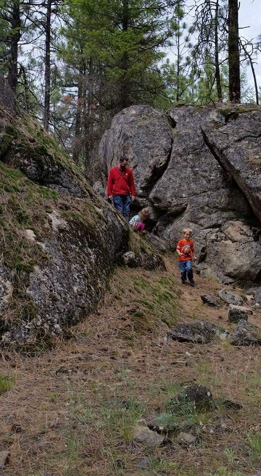
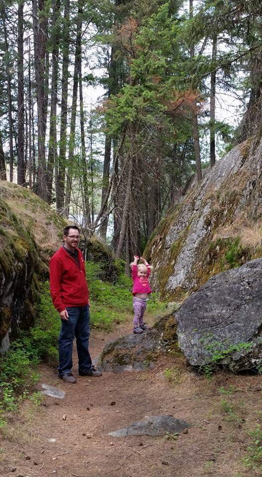
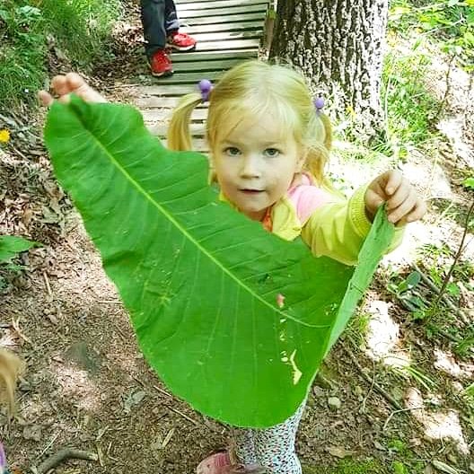
I began hiking and fell in love with it for a multitude of reasons. The fresh air, open space, exercise, and ability to experience places not easily seen by everyone. Through the years more reasons have been added to my list. When I hike with my children they help me slow down and notice the little things. We pick up sticks, find cool rocks, and investigate the leaves. We talk A LOT and about anything and everything. We talk about hiking, how to be safe, how to take care of the trails and nature. We don’t make good time mileage wise, at least not yet, but we make memories that last. I would not trade them for anything.
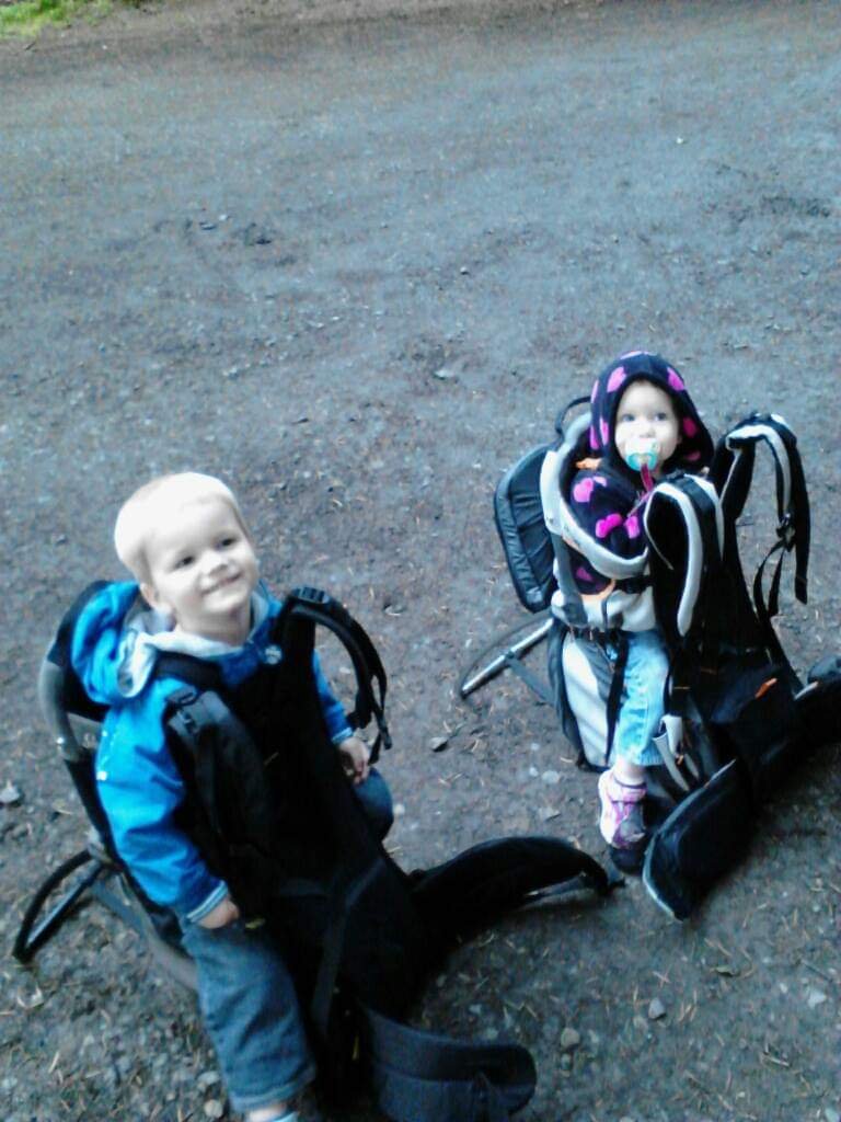
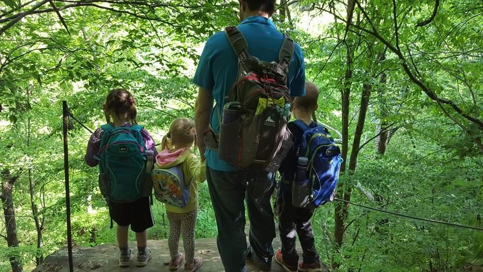
We started hiking with our kids before they could walk. A quality child hiking pack is important at this stage. As they reached toddler years we started having them walk safe portions of the trails. We let them hold sticks and leaves (not always very pleasant for my head). The older they got, the more they walked and the slower we became. It was a necessary sacrifice to help build their comfort outside as well as their stamina.
Our two oldest children at ages 3 and 1 getting ready for a hike. Spring 2017 hiking in Northern Alabama.
As they were growing and starting to get harder to hold we needed to help encourage them to push through and continue hiking. At this point we offered each of them a goal. We told them if they successfully hiked three 2+ mile hikes in a row without being carried they would earn their own hiking bag!! This was actually very motivational for them. It also allowed us to give them their own water bladder and to have them begin carrying their own snacks and small toys if they wanted them. Once they earned their bags then if they complained or wanted carried we could simply remind them that they have proven they CAN hike, even when it is hard or they are tired.
Our youngest earned her hiking pack after our Georgia trip! We picked it up at REI in Chattanooga, TN.
Our oldest is turning 10 this summer and is a very confident hiker, and our younger two are also well on their way. We are starting to be able to hike further and a bit faster these days. Speed to me is not the most important thing, I love that they enjoy hiking and nature. I hope this will be something that will carry us through their teen years and help us to continue to feel connected.
Our tips for hiking with kids:
Find a comfortable Child Carrier.
Bring lots of snacks. Space them out on the trail (they are great motovation for kids).
Choose a hike based on the abilities of all in your group, including the children.
Encourage the child/children to hike as much as possible on their own. This will sometimes feel frustrating but in the long run it is beneficial. They are learning to hike. Try to make it fun for them!
Familiarize yourself with first aid and other safety measures. Hiking with young kids often means first aid will be necessary.
Slow down and enjoy nature. Use the slower pace as an opportunity to teach and connect with your child.
When they are old enough get them a backpack sized correctly for them, and add a water bladder. We LOVE the child sized day packs by REI.
Georgia 2017Spring 2020 in Lake County, Oregon
I hope you feel inspired to get out and hike and explore with your children. If you don’t have kids of your own, hopefully this information will help if you ever join a family/friends with kids on a hike! Our children love encountering friendly hikers on the trail. Hikers who understand how kids hike and encourage them are immensely inspiring for our children.
We had the pleasure of visiting Shirk Ranch this spring. Shirk Ranch is a historic ranch located in the Guano Valley near the small town of Adel, Oregon. The ranch was first Homesteaded in 1881 and was purchased by David L. Shirk in 1883.
David L. Shirk operated his ranch on the property until 1914. The property went through a few exchanges and was eventually acquired by the US Government in the year 1942. The ranch is now managed by the Bureau of Land Management (BLM).
Map from Wikipedia
We had fun walking through the abandoned house, barn, and all the other buildings. It was fun to imagine what it must have been like to homestead there 100 years ago. There are still a lot of items left to see on the property and beautiful views any direction you point your camera!
I highly recommend this visit. Please remember to be kind to this, and all other, pieces of living American history. It is a protected historic site, so remember to take only memories and pictures, and as always, tread lightly. Items on the property need to be left for others to enjoy (though we did remove some garbage left by other recent visitors). Also, keep in mind that this is not a developed recreation site so there are no restrooms or trash collection, so plan accordingly.
We headed out to explore the surrounding countryside and discovered that once things dry out a bit more, there would be a lot of roads to explore. There is a scenic reservoir, nature area, and you can even take some dirt roads into the back side of Hart Mountain. This would make for a wonderful trip, but it was too early in the season for us to make it very far. They were very muddy in sections and the snow level was still too low in elevation. We hope to go back this summer and make the loop.
We were reminded of a one of the most important rules of adventuring, especially in the Oregon Outback:
If at all possible you should make sure someone knows your plans and when to expect you back. This is a remote area with little to no cell service, which is absolutely a large part of the fun, but not somewhere you want to get stuck. Being prepared is always a priority in this area.
I hope you take some time and make a trip out to Shirk Ranch! Check out Doherty Slide while you’re there and eat at the historic restaurant in Adel. There is plenty to see in this area! If you are planning to visit and want more ideas feel free to comment or send us a message and we will be happy to share some ideas!
Happy Adventuring,
Stephanie
The gravesite near Shirk Ranch
Check out wikipedia for more information about Shirk Ranch. Driving directions coming soon. We used Google Maps and made it safely but we had a clear idea of where we were heading and what to expect.
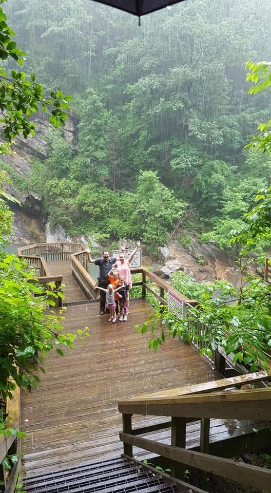
Descending Doherty Slide (1000 ft descent)Abiqua Falls – Mother’s Day Hike 2015
I have been asked the following questions over and over again throughout the years: Where do you find your adventures? How do you get your kids to happily hike? When should you start taking kids hiking with you?
Exploring the Blue Ridge Mountains – Summer 2018Wide Open Roads in Lake County, Oregon.
Where do we find our adventures?
This is a question we have been asked for years in almost every state we have lived. We are asked this question by people newer to the area than we are which is not surprising. But then we are just as frequently asked by people who may have lived in the area their whole lives!
The answer though seemingly simple is a rather complex one. First it starts with being prepared. We are ALWAYS overpacked and packed for multiple possibilities. For example we carry recovery gear in our truck even if we are planning to go to a state campground. Our kids hike with backpacks, which each contain their essential supplies, even if we are just going on a one mile hike, as do we. The reasons for this level of preparedness is that we are NEVER quite sure where we will end up or what will happen. We have learned to prepare ahead of time for multiple possibilities. These include the real possibilities of getting stuck, hurt, or stranded. Our number one goal while exploring has always been to be safe and keep our kids safe. There is always, despite that goal, the possibility of getting hurt, so we try to be prepared and to have a plan.
We have talked through and trained our kids in trail safety and ettiquite. Our kids have been taught to fall uphill if we are hiking in a steep area. They have been taught what to do if they get separated from us. They have been taught basic orienteering using trails, trees, creeks, rivers, and hillsides. They are just about old enough now to be taught to make a safe fire, and how to use a map and compass together. That being said, our preparedness has changed throughout the years and with our family member’s ability levels. Use your best judgment and know your limits. If you have to ask yourself multiple times if you are safe, or if you should turn back… better to be cautious and safe, than stranded and in trouble!
Exploring with others is always best! This is with our Buddies @suburbanoverland. Overlooking Summer Lake, OR at Fremont Point.
First thing that happens when we move to an area or when we visit a new area is research. We don’t just look at pamphlets that are handed out, or at the state or local forests website. We search online, we look at maps, we look up the local history, anything we can do to find and get a feel for what we may encounter.
Once we have a good idea of what is around, we will often choose a drive or an area we want to start exploring. These exploration drives involve a lot of stopping, side roads, and diversions. This is how we find a lot of neat adventures that may not be as well known. We make notes about what we want to come back and do later. This is how we begin building our lists of adventures to do around the area.
These drives become adventures in and of themselves because we are never quite sure if our planned route will work out, or what we may find that brings us away from our planned route. This is why we travel prepared for multiple possibilities. We may go out looking for a hike in the desert, but instead find ourselves enjoying a campground in the mountains. We very often encounter closed or impassable roads. Practicing leave no trace for us also involves trying to avoid tearing up roads, so sometimes we turn around or change course to avoid muddy roads.
The kids have mixed feelings some days about our driving adventures. They don’t always find them exciting, so we try to do a few things to help make them more fun. We stop, get out of the truck and let them explore when we find an interesting area. We let them get wet, muddy, and dirty if that is what comes up! We generally pack a picnic lunch and find somewhere fun to eat. We also talk to them about our plan and our route and we give them choices about where we go explore. When they have more ownership and choice about what we do they become more invested in it and have a lot more fun.
Always exploring
We use the following mapping programs most often:
Avenza Maps (a lot of free USGS Maps – can purchase other maps for various fees)
Gaia Maps (free version)
US Topo Maps Pro (single app purchase, no subscription, but maps are a little outdated)
Google maps (sometimes, not very reliable on Forest Service roads, cannot be counted on as the only mapping source).
That is a quick summary of how we find some of our adventures and places to explore. It is a fun process that is often unpredictable. Honestly I greatly enjoy the unpredictability of these drives! It is a good reminder that even the best laid plans don’t always work, and most importantly that plans can be adjusted and often our unexpected turns have led to our greatest discoveries and adventures!
Stay tuned for part 2! I will talk about hiking with kids and how our children have changed and grown as hikers through the years. I will include some of our favorite tips, as well as some harder lessons we have learned.
Near the cute little town of Cedarville, CA is a very nice trail. The Cedar Creek trail is open to hikers, mountain Bikers, as well as horses. It is a 6.5 mile out and back trail with two trailheads (upper and lower).
Our children were not keen on hiking the 6.5miles when we went, so we compromised. We first stopped at the upper trailhead and locked my bicycle up. We then drove all of us down to the lower trailhead so we could hike from the lower trailhead to the upper.
Once we reached the upper trailhead, I then hopped on my bike and rode the easy downhill 3 miles back down to our truck. I took side roads and hooked up with the smooth easy part of the trail.
I loved that this hike was scenic, near a river, and had many ways to enjoy it. I imagine we will go back again and enjoy the hike and maybe even play in the creek!
Important information –
* The hike is located off Hwy 299 over Cedar Pass. The upper trailhead can be found at the base of the ski hill (signs for the ski area are located on 299 just past the summit) and the lower trailhead is a few miles further down hwy 299 and is a large pull off right on the side of the highway.
* There are a few creek crossings, there were logs that were present at each but no bridges etc. Two of them are pictured above and they are all closer to the upper trailhead.
* When hiking from the lower Trailhead there will be a small side trail. When we went through there was a stack of rocks that marked the smaller trail. This trail will be smaller, but it brings you much closer to the creek. I highly recommend that route. I took the other trail on my way back to the car and while pretty, and a smooth easy hike/ride, was not as scenic in my opinion.
This was a wonderful hike and would be great for new hikers. The trail is well established and a nice smooth grade. We saw a handful of other people on the trail when we were there, so you more than likely won’t be alone, but it was also not anywhere near crowded.
Leave a comment if you have any questions or tips if you have been here before! Also be sure to check out Cedarville, it is a very cute town and they have a nice park.
This hike is found just inside Hart Mountain Antelope Refuge in DeGarmo Canyon. DeGarmo falls was a very fun but challenging hike to a nice falls! Waterfalls are not common in the Oregon Outback so we were excited to find one!!
The Trailhead has ample parking, there are no restrooms or garbage service so please plan accordingly. I recommend a high clearance vehicle to get to the Trailhead in order to avoid rocks in the roadway.
At the beginning of the hike you will come to a creek crossing. Do not cross the creek at the first place spot you can. You are instead going to climb up the rocks to the right between the creek and the hillside. You will have to push the shrubs out of your way and climb up the sloping rock. It seems more intimidating than it is. We all made it safely, just watch your footing. After you climb over the rocks you will see another spot to cross the creek. This is where you cross and climb up the hillside a little ways on the otherside so you can follow the trail upriver.
This is where you are not supposed to cross. It is right above a small falls and isn’t a safe crossing point, plus the trail officially crosses a little further upstream.This is part of the rocky area you will climb to reach the creek crossing.
After that point the trail is pretty easy to follow and it takes you along the creek. You will see some impressive rock outcroppings and follow the trail through the canyon. It is a fairly easy grade most of the way.
After some hiking along the stream you will come to an area where you start climbing and will soon get your first glimpse of the falls.
At about this point looking up into the hills you will see some caves in the rocks. Continue following the trail and you will reach the falls soon. Watch your footing as you descend the trail to the falls, all three kids slid at that point in the trail.
At this point, especially if hiking with kids, you should enjoy the falls and then turn around and hike the same route out of the canyon. We decided to try and make a loop hike and followed directions to scramble up the side of the canyon to join the old cattle trail, and hike that back to the trailhead.
This proved to be difficult process as adults, it was especially challenging and potentially dangerous for the kids. We thought that we had scrambled far enough up the hill and saw a trail so we started to follow that trail upstream. We were supposed to hike another half mile upstream to reach the next 500ft scramble up the canyon. We never found an obvious area to scramble up, but did find lots of stacked rocks marking the trail we were on? To be honest we are not sure if we were on the right trail or not. We decided finally to just make the scramble up the hill and luckily came across another trail (we think this was the cattle trail) leading us out of the canyon.
We hiked along the upper trail towards the mouth of the canyon and the views were spectacular!
At this point in the trail (picture above) we could see the trailhead down the side of the canyon. The trail we were on seemed to continue the wrong direction? We were unsure whether we should continue to follow the trail or just start our trailblazing/scramble back down to the trailhead. The directions we were following told us we would be doing an approximately 500ft scramble to return to the trailhead. We chose to keep following the trail we were on hoping it would turn back towards the Trailhead bringing us further down the canyon before we started off trail. However, the trail just continued going away from the trailhead and then started to disappear. We decided at that point that we better just head towards the trailhead. So down we went (very glad we had long pants and good bug spray on to help avoid ticks).
We finally reached the creek crossing that is just downstream from the trailhead! Everyone was exhausted from the hike, and glad to be back at the truck.
A few tips to end with – This hike was a blast and we remember it fondly, but it was hard for us because we took the upper trail back. Hiking to the falls and back is very doable for a sure footed hiker. The waterfall was amazing when we were there in early spring. We have been told by others going later in the season it is very buggy (full of mosquitos).
A good bug spray is a must. We did this hike in the early spring so snakes were not likely, during summer and early fall you may encounter some so keep an eye out. We keep childrens benadryl in our daypacks, with our first aid kit, just in case of a bite. That way we can get an antihistamine in quickly and then head out for help. We do not recommend the upper trail unless you are an experienced hiker, okay with heights, scrambling up steep slopes, and have and know how to read a topographical map (our topo map was a HUGE help in keeping us on track throughout the upper trail).
I posted a link under the next picture to a website with more information and some helpful maps and directions. Please read through that information before your trip and print the directions out to bring with you. The map on the website linked was ok and helpful but we had an USGS Avenza map (Hart Lake Quadrangle 7.5 Minute Series) that was more topographically detailed and was a great extra resource. The USGS map does not show the trail which is why the printed trail map is needed also. Don’t expect to have mobile or data service as the hike is very remote. It was a great day and a great hike all around, but in the end we wished we had stayed on the main trail since we had young kids with us.
Happy Adventuring,
Stephanie
The first website below has travel information and printable topographical maps.
This Spring we took a trip out to Derrick Cave which is near Fort Rock, Oregon. Getting there is a bit of a trick because we did not have the map that I have put in this post. This was actually our third attempt to find Derrick Cave because we tried to go the closed route the first time around.
A map of the open route to Derrick Cave. The closed route went through private land and is no longer open for public use.
Make sure if you plan to go to the cave that you avoid wearing the same clothing/shoes ect that you have worn in other caves. It is important to protect our bat population from the devastating White Nose disease.
Information about how to protect the cave.
This cave has a very interesting history. It was declared an air raid shelter during WW2, then it was again designated as a shelter, but from nuclear fallout during the cold war. In the 1960’s a thick heavy door was installed to store enough food and water in the cave for up to 1200 people! Up until about 1994 the BLM allowed camping inside the cave but it is no longer allowed. Check out Wikipedia for more detailed history on the cave.
Derrick Cave is HUGE. At 0.215 miles long and up to 80ft wide and 46ft tall it is an impressive lava tube. When we were there, we found some remaining ice stalagmites still on the ground. As well as some sheets of ice on the ground in areas. It was tricky to walk in places and to get all the way to the end of the cave you will have to do some climbing over some boulder piles. You will want good shoes, coats (or sweaters at a minimum), and sufficient lighting with backups in case batteries run out etc.
This is an amazing cave and we all enjoyed it! Just like with any other trip it takes a bit of preparation. The roads were decent getting out there, but you will want a high clearance vehicle and I would avoid going during the wet seasons when the roads would be muddy. Have fun!
We took a short hike from Lofton Reservoir to Heart Lake. Lofton Reservoir is located about an hour west of Lakeview off highway 140.
We were already camping at Lofton Reservoir (post to come) and were very excited to find the trail to Heart Lake very close to the campground.
We started the hike with this crew, the youngest and Lulu the pup went back to camp pretty quickly. They were not as excited about the proposed hike as the rest of us. We arranged it so we would be picked up at Heart Lake because we had a little friend with us who has never hiked before and was not prepared for an almost 4 mile hike.
The trail climbed a little at the beginning before leveling off with amazing views!
It was a well maintained and marked trail. There were some spots we found with tall grass or that wound up through some large rocks.
The whole time we loved the hike. We found butterfly’s and some other fun things along the way.
Watching the butterflies
At the end we found Heart Lake which was beautiful! At Heart Lake we found a couple little snakes hanging out on the dock as well as some frogs the kids had fun catching.
Heart Lake
Heart Lake
Our friend the frog – released back to his home shortly after this picture.
Hello little snake…
This is a fun little hike with good views, a pretty easy trail, and is great for kids. As I said before we hiked it one way (1.75 miles) for the sweet little girl who was new to hiking, but you could easily continue on to Big Swamp Reservoir or turn around and head back to Lofton Reservoir which would make it a nice 3.5 mile round trip hike or trail run. We did see quite a few bicycle tracks so it looks like it may be a fun mountain bike trail ride also!
Happy Adventuring!
Stephanie
Directions to Lofton Reservoir:
Lofton Reservoir Campground is located one hour 35 minutes east of Bly.
From Bly, OR follow Oregon Highway 140 east toward Lakeview, Oregon. Turn right onto Forest Road (FS) 3715 then right on FS Road 013 to campground.
Today we attended the 19th annual Wild Goose Chase which is organized by the Lakeview Rotary Club. The proceeds each year go directly back into the community. This year they went to providing much needed pool covers for the Town of Lakeview’s Pubic Pools.
Each little goose released has a number on the bottom of it. That number matches it to a ticket that was purchased by a member of the community. There were amazing prizes for the winners!
This was our first year attending the Wild Goose Chase and I was very excited to see what happened and how it all was done. My husband is a new member of the Lakeview Rotary, so we made sure we were there early to help set up. We were pleasantly surprised to find people gathering and visiting before the event. There was even a bbq where they made hamburgers and hotdogs for those attending!
Right on time at 12:00 they released the wild Geese into Drew’s Creek where they would travel about 1/2 mile (what I heard) down the creek to the catch spot where we would be able to collect the winners.
After the release we all ran across the road to see them start their journey down the creek.
Then we made our way back to the finish line. It took approximately 12 minutes until we found the first ducks approaching the finish line. The excitement was real as the first 3 battled for the winning position!
This was a really fun community event! The rotary does a great job with it, it was organized and well planned out. I still think it is amazing to see how the community comes together for events such as this one. The prizes were amazing for those who won, but really all of Lakeview wins because the money goes directly back to the community to a worthy and needed cause each year.
Tall Town Bike and Camp in Lakeview is hosting a talk by a couple who are from Paisley, Oregon. They will be discussing their cycle tour through Southern Chile and Argentina.